Search the Community
Showing results for tags 'PDS'.
Found 9 results
-
A new database has been added to the PDS Geosciences Node Spectral Library. Frankenspectra Database Bundle - A SSERVI funded project to analyze, using reflectance spectroscopy, 27 fine-particulate (less than 10-um) terrestrial minerals to create a far-UV through MIR single spectrum built from the best pieces of spectra acquired at multiple US and international labs. https://pds-speclib.rsl.wustl.edu/
-
 The PDS Geosciences Node has a new a quick start user guide for viewing PDS images and exporting the images to other formats. The guide is intended to help new users learn how to use free tools that are available with basic viewing and format transformations of PDS images. Document Link (PDF): Viewing PDS Images and Exporting to Other Formats
 -
Is the information about the direction of one of Curiosity's camera included in the PDS Label information? Could someone explain how to translate the data information so that the bearings of the camera when a picture was taken can be understood according to North-South-East-West on the martian planet? Thanks, Leslie Charles
-
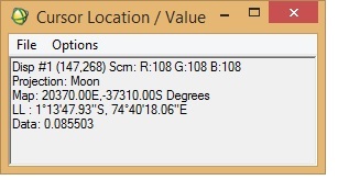
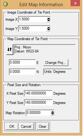
I want to georeference an M3 image (obtained via PDS) in ENVI. I was following "Assigning Map Information to PDS Images in ENVI", posted by Dr June Wang. I was able to perform most of the steps. Yet when the process is complete, it seems that the georeferencing is not correct. I have attached a couple of screenshots from the M3 image I was working with. To check the accuracy of georeferencing, I cross-checked the location from Google Moon and found that there are a lot of discrepancies between the 'georeferenced' M3 image and Google Moon. In the 'Edit Map Information' window, I entered X-pixel and Y-pixel sizes as 140. Please let me know if this is correct. When I cross-checked with Google Moon, the top of the image should have latitude as north and the bottom the image as south (also verified from LOC file of the M3 image). Please help.
-
 May 7, 2021 – MRO HiRISE Updates - MRO HiRISE EDR, RDR, DTM and Anaglyph data products released through April 7, 2021 (Orbit 68899) New data available through below links ODE product search page: https://ode.rsl.wustl.edu/mars/indexproductsearch.aspx ODE map search page: https://ode.rsl.wustl.edu/mars/indexMapSearch.aspx ODE data holdings page: https://ode.rsl.wustl.edu/odeholdings/Mars_holdings.html
 -
- MRO HiRISE EDR, RDR, DTM and Anaglyph data products released through March 7, 2021 (Orbit 68499) New data available through below links ODE product search page: https://ode.rsl.wustl.edu/mars/indexproductsearch.aspx ODE map search page: https://ode.rsl.wustl.edu/mars/indexMapSearch.aspx ODE data holdings page: https://ode.rsl.wustl.edu/odeholdings/Mars_holdings.html
-
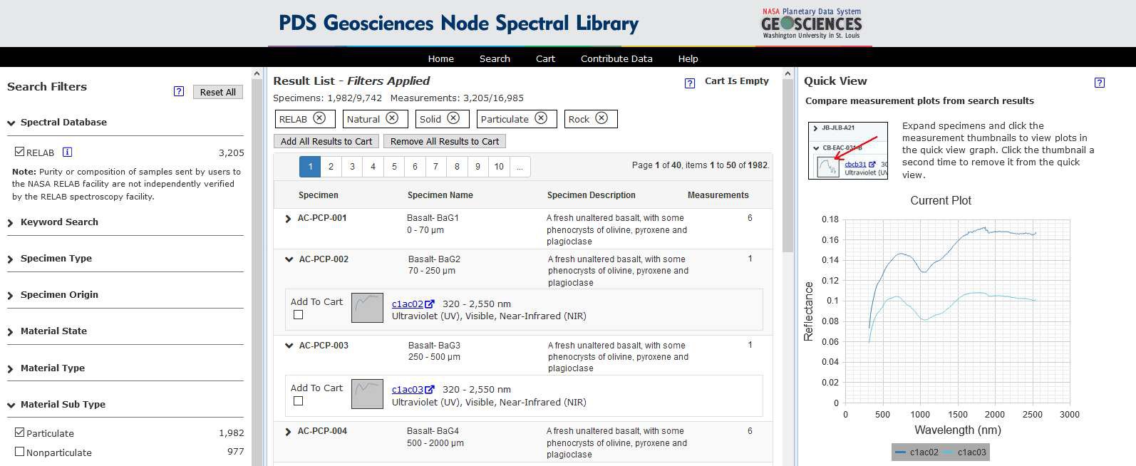
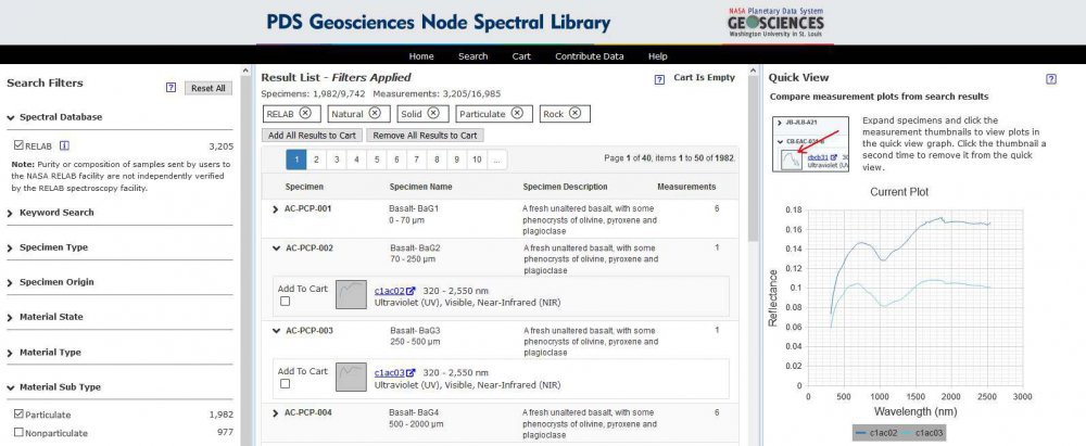
We are pleased to announce the release of the PDS Geosciences Node Spectral Library website. See the release announcement under the main forum announcements. Feel free to ask questions and provide feature requests on this forum. Thanks!
-
We are pleased to announce the release of the new PDS Geosciences Node Spectral Library website. The PDS Geosciences Node Spectral Library is a database of laboratory spectra submitted by various data providers. It currently includes spectra from the Reflectance Experiment Laboratory (RELAB) at Brown University. Additional data sets will be added to the website in the coming months. The website allows users to search the catalog of specimen and measurements using a facet search. Results can be viewed in quick view summary or full detail pages. Measurement data can be downloaded individually or through a cart system.
-
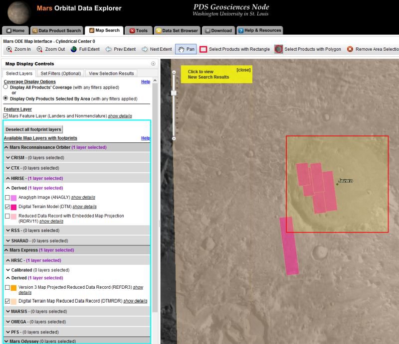
The ODE map search has been updated to have product coverage map layers grouped by mission/instrument/processing level. This map layer organization matches the product search page. Mars Orbital Data Explorer Map Search Lunar Orbital Data Explorer Map Search Mercury Orbital Data Explorer Map Search Venus Orbital Data Explorer Map Search Mars ODE Map Search Example: