Catalina Torres
-
Posts
8 -
Joined
-
Last visited
Catalina Torres's Achievements
")
Rookie (2/14)
-
 Rare
Rare
-
 Rare
Rare
-
 Rare
Rare
-
 Rare
Rare
-
 Rare
Rare
Recent Badges
-

Inconsistent ROI statistic results
Catalina Torres replied to Catalina Torres's topic in For data users
Ideally, what should be the file I am extracting the ROIs from? -
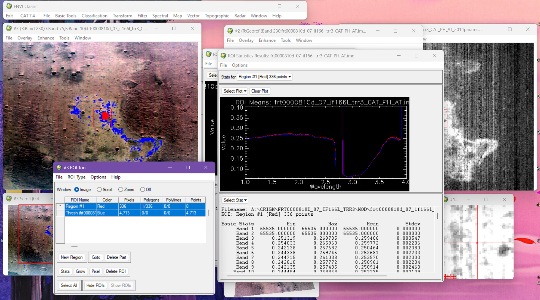
Hi, I've been working with TRDR CRISM data, specifically trying to identify minerals with the CRISM Spectral library but I keep on ending up with the same spectral signature every time. I corrected atmospherically and photometrically my data cubes and also I have created my IR Summary products. I know something's off because the statistic results are always the same, no matter if I'm working with a D2300 parameter or a BD1900r2 or even with different observations (CRISM scenes) I keep on getting the same results. Could someone help me solve this issue or maybe help me recognize what might be wrong? I'd really appreciate it. Thanks

-
Nevermind. I just found out how, thanks!
-
Hi Feng, I was taking a look at the document you sent me and couldn't help but wonder, in which moment should I "map project" my TRR data? Is it before I make the PDS to CAT conversion or after? It is still not clear for me since I haven't been able to find that in the document. I'm asking this because I noticed that my image looks inverted and I believe it's because of the projection. Again, thanks a lot, the information you have given me has helped.
-
Absolutely! I will. Thank you so much Feng.
-
Catalina Torres changed their profile photo
-
CAT Error in "project single cube data"
Catalina Torres replied to Catalina Torres's topic in For data users
Hello Feng, first of all, thank you for your time and help. Yes, I have recently installed CAT, so I'll try either switching CAT to it's older version or updating ENVI. Also no, this is the first time I see the error. Thanks a lot, I'll try first what you recommended and will let you know if a meeting is needed. Again, thank you! -
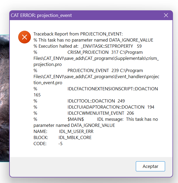
Hello, community I was hoping someone could help me fix this error (image below) that I get when I try to project CRISM I/F TRDR data. I already tried fixing the problem by following the instructions from https://pds-geosciences.wustl.edu/missions/mro/CAT_mapProjection_Fix.pdf but it didn't seemed to help. It might seem obvious for some, but I'm using ENVI 5.3 and CAT 7.4. Any advice would be appreciated.
-
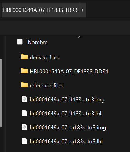
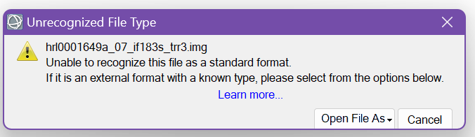
Hi, My name is Cat and I'm and undergraduate student. I'm willing to work with I/F TRR CRISM data but I have a doubt in matter of which data should I download between the sensor S (short) and the sensor L (long). Is there any difference? My main goal is to identify minerals with spectral signatures obtained from the data, does choosing between one or another influence in the identification process? Also, after the download of all the products and derived files, which file is the one I should load to ENVI in order to start it's corrections? For example (image 1 below), is it the one contained in the "derived_files" or which one from the photo? I would really appreciate it if you could indicate me since I have been opening almost all of the files in ENVI but the continuosly end up in an error (image 2 below). Thanks. image 1: files image 2: ENVI opening file error