Search the Community
Showing results for tags 'ratioed i/f corrected spectra'.
Found 2 results
-
Just wondering if there any automated method to make ratio image (I/F ratio or pixel-wise ratio) of MTRDR data. Since the image is projected, how to find denominator (or column median) in MTRDR data for extracting ratio spectra?
-
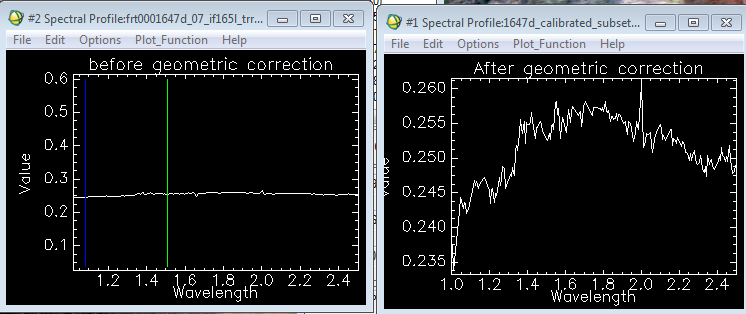
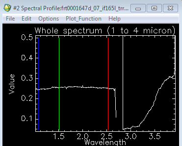
 Hi, I need some help to understand the data processing of CRISM data (TRR3). I use CAT tool coupled with ENVI 5.3. I use CAT manual (workshop manual available in the website) for the processing which goes as Conversion of PDS to CAT--> Photographic and Atmospheric Correction--> Georeferencing. I observe that after the atmosphere correction spectra do not change much but once perform the geometric correction it shows changes as shown in the figure. Is obtained result correct? What is the main reason for this change? I would also like to know how to obtain ratioed spectra. I am familiar with spectra ratios but my confusion is how to choose spectra (denominator) which does not introduce errors, what region' pixels would be a better choice? Is atmospherically corrected spectrum same as I/F spectrum? All plots are atmospheric corrected. Thanks,