Search the Community
Showing results for tags 'Crism'.
-
Hello, What do I need to define a new mineral Type Locality? How do I search for new minerals that have not yet been defined with a type locality? I thought of calculating the RGB color of a target mineral lab reference spectrum, with related summary products and then looking for pixels in the related Browse Product scene that have a similar color. Is it a good way? If yes, how do I do the band math on a spectrum instead of on an image? And is there a way to do this with the codes from the directory ‘CAT_ENVI\save_add\CAT_programs\Additions\SummaryParams2014’ ? Thanks, Nathan
-
March 3rd, 2022 - MRO Release 60 Loaded into ODE. - Updated MRO CRISM EDR and CDR products from September 27th, 2006 to November 8th, 2021. - Updated MRO CRISM DDR products from September 27th, 2006 to November 8th, 2021. - Updated MRO CRISM TRDR products from September 27th, 2006 to November 8th, 2021. - Updated SHARAD Radargram data products released from May 25th through August 10th, 2021 (orbits through 70498). - Updated SHARAD EDRs and RDRs from SHARAD Operations from May 9th to August 12th, 2021 (orbits through 70525). - Updated MRO MCS EDR, RDR and DDR products from September 15th, 2006 to October 31st, 2021 (orbits through 71556). - Updated MRO CTX EDR products from August 30th, 2006 to August 31st, 2021 (orbits through 70773). - Updated MRO HiRISE EDR, RDR, DTM and anaglyph products released through February 5th, 2022 (orbits through 72799). New data available through below links ODE product search page - https://ode.rsl.wustl.edu/mars/indexproductsearch.aspx ODE map search page - https://ode.rsl.wustl.edu/mars/indexMapSearch.aspx Please see ODE Mars Holdings - https://ode.rsl.wustl.edu/odeholdings/Mars_holdings.html
-
Release 60 from the Mars Reconnaissance Orbiter mission includes new CRISM and SHARAD data. The data are online at https://pds-geosciences.wustl.edu/missions/mro.
-
 January 31st, 2022 Release 19 of MRO CRISM MTRDR (Map-projected Targeted Reduced Data Record), TER (Targeted Empirical Record), and TRDR (Targeted Reduced Data Record) browse and extras data has been loaded into ODE. This release fills in data from February 9, 2010, through December 24, 2011. This is the final regular release of these data types. New data available through below links ODE product search page: https://ode.rsl.wustl.edu/mars/indexproductsearch.aspx ODE map search page: https://ode.rsl.wustl.edu/mars/indexMapSearch.aspx ODE data holdings page: https://ode.rsl.wustl.edu/odeholdings/Mars_holdings.html
 -
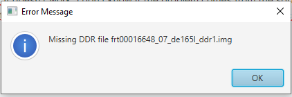
Hello everyone, I'm working on CRISM data, I want to use JCAT, but apparently it doesn't work, I don't know if the problem comes from the software or something else, when importing the file "frt00016648_07_if165l_trr3", an error message appears indicating that the ddr file is missing, while the folder I'm working on contains all the necessary files including the ddr.
-
This is the 19th release of CRISM MTRDR and TER data products. In addition, the volumes MROCR_2104, MROCR_2105, and MROCR_2106 are updated with new TRDR browse and extras data products.
-
December 3rd, 2021 - MRO Release 59 Loaded into ODE. - Updated MRO CRISM EDR and CDR products from September 27, 2006 to August 9, 2021. - Updated MRO CRISM DDR products from September 27, 2006 to August 8, 2021. - Updated MRO CRISM TRDR products from September 27, 2006 to August 8, 2021. - Updated SHARAD Radargram data products released through May 24, 2021 (orbits through 69498). - Loaded reprocessed SHARAD Radargram data products with coverage: August 21, 2007 - September 13, 2008 (Orbits 5000-9993), November 1, 2010 - January 13, 2014 (Orbits 20000 – 34996) - Updated SHARAD EDRs and RDRs from SHARAD Operations from November 8, 2020 to May 8, 2021 (orbits through 69294). - Updated MRO MCS EDR, RDR and DDR products from September 15, 2006 to July 31, 2021 (orbits through 70376). - Updated MRO CTX EDR products from August 30, 2006 to June 1, 2021 (orbits through 69593). - Updated MRO HiRISE EDR, RDR, DTM and anaglyph products released through November 4, 2021 (orbits through 71597). New data available through below links ODE product search page - https://ode.rsl.wustl.edu/mars/indexproductsearch.aspx ODE map search page - https://ode.rsl.wustl.edu/mars/indexMapSearch.aspx Please see ODE Mars Holdings - https://ode.rsl.wustl.edu/odeholdings/Mars_holdings.html
-
Release 59 from the Mars Reconnaissance Orbiter mission includes new CRISM and SHARAD data. The data are online at https://pds-geosciences.wustl.edu/missions/mro.
-
September 3rd, 2021 - MRO Release 58 Loaded into ODE. - Updated MRO CRISM EDR and CDR products from September 27th, 2006 to May 9th, 2021. - Updated MRO CRISM DDR products from September 27th, 2006 to May 8th, 2021. - Updated MRO CRISM TRDR products from September 27th, 2006 to May 8th, 2021. - Updated SHARAD Radargram data products released through February 17th, 2021 (orbits through 68267). - Updated SHARAD EDRs from SHARAD Operations from May 10, 2020 to February 13th, 2021 (orbits through 68218). - Updated MRO MCS EDR, RDR and DDR products from September 15th, 2006 to April 30th, 2021 (orbits through 69195). - Updated MRO CTX EDR products from August 30th, 2006 to February 28th, 2021 (orbits through 68411). - Updated MRO HiRISE EDR, RDR, DTM and anaglyph products released through August 2nd, 2021 (orbits through 70399). New data available through below links ODE product search page - https://ode.rsl.wustl.edu/mars/indexproductsearch.aspx ODE map search page - https://ode.rsl.wustl.edu/mars/indexMapSearch.aspx Please see ODE Mars Holdings - https://ode.rsl.wustl.edu/odeholdings/Mars_holdings.html
-
September 28th, 2021 Release 18 of MRO CRISM MTRDR (Map-projected Targeted Reduced Data Record), TER (Targeted Empirical Record), and TRDR (Targeted Reduced Data Record) browse and extras data has been loaded into ODE. This release fills in data from August 14, 2008, through December 10, 2011. New data available through below links ODE product search page: https://ode.rsl.wustl.edu/mars/indexproductsearch.aspx ODE map search page: https://ode.rsl.wustl.edu/mars/indexMapSearch.aspx See https://ode.rsl.wustl.edu/odeholdings/Mars_holdings.html for more information.
-
This is the 18th release of CRISM MTRDR and TER data products. In addition, the volumes MROCR_2103, MROCR_2104, MROCR_2105, and MROCR_2106 are updated with new TRDR browse and extras data products.
-
June 7th, 2021 - MRO Release 57 Loaded into ODE. - Updated MRO CRISM EDR and CDR products from September 27th, 2006 to February 9th, 2021 - Updated MRO CRISM DDR products from September 27th, 2006 to February 8th, 2021 - Updated MRO CRISM TRDR products from September 27th, 2006 to February 8th, 2021 - Updated SHARAD Radargram data products released through November 10th, 2020 (orbits through 66998) - Updated MRO MCS EDR, RDR and DDR products from September 15th, 2006 to January 31st, 2021 - Updated MRO CTX EDR products from August 30th, 2006 to November 30th, 2020 - Updated MRO HiRISE EDR, RDR, DTM, and anaglyph products released through May 1st (Orbit 69199), 2021 New data available through below links ODE product search page - https://ode.rsl.wustl.edu/mars/indexproductsearch.aspx ODE map search page - https://ode.rsl.wustl.edu/mars/indexMapSearch.aspx Please see ODE Mars Holdings - https://ode.rsl.wustl.edu/odeholdings/Mars_holdings.html
-
June 7th, 2021 Release 17 of MRO CRISM MTRDR (Map-projected Targeted Reduced Data Record), TER (Targeted Empirical Record), and TRDR (Targeted Reduced Data Record) browse and extras data has been loaded into ODE. This release fills in data from 2008_222 through 2009_116. New data available through below links ODE product search page: https://ode.rsl.wustl.edu/mars/indexproductsearch.aspx ODE map search page: https://ode.rsl.wustl.edu/mars/indexMapSearch.aspx See https://ode.rsl.wustl.edu/odeholdings/Mars_holdings.html for more information.
-
This is the 17th release of CRISM MTRDR and TER data products. In addition, the volume MROCR_2103 is updated with new TRDR browse and extras data products.
-
March 8th, 2021 - MRO Release 56 Loaded into ODE. - Updated MRO CRISM EDR and CDR products from September 27th, 2006 to November 9th, 2020 - Updated MRO CRISM DDR products from September 27th, 2006 to November 9th, 2020 - Updated MRO CRISM TRDR products from September 27th, 2006 to November 8th, 2020 - Updated SHARAD Radargram data products released through August 9th, 2020 (orbits through 65799) - Updated MRO MCS EDR, RDR and DDR products from September 15th, 2006 to October 31st, 2020 - Updated MRO CTX EDR products from August 30th, 2006 to August 31st, 2020 - Updated MRO HiRISE EDR, RDR, DTM, and anaglyph products released through February 4th (Orbit 68099), 2021 New data available through below links ODE product search page: https://ode.rsl.wustl.edu/mars/indexproductsearch.aspx ODE map search page: https://ode.rsl.wustl.edu/mars/indexMapSearch.aspx Please see ODE Mars Holdings – https://ode.rsl.wustl.edu/odeholdings/Mars_holdings.html
-
March 8th, 2021 Release 16 of MRO CRISM MTRDR (Map-projected Targeted Reduced Data Record), TER (Targeted Empirical Record), and TRDR (Targeted Reduced Data Record) browse and extras data has been loaded into ODE. This release fills in data from August 9 through December 25, 2008 (2008_222 to 2008_360). New data available through below links ODE product search page: https://ode.rsl.wustl.edu/mars/indexproductsearch.aspx ODE map search page: https://ode.rsl.wustl.edu/mars/indexMapSearch.aspx See https://ode.rsl.wustl.edu/odeholdings/Mars_holdings.html for more information.
-
This is the 16th release of CRISM MTRDR and TER data products. In addition, the volume MROCR_2103 is updated with new TRDR browse and extras data products.
-
Release 56 from the Mars Reconnaissance Orbiter mission includes new CRISM and SHARAD data. The data are online at https://pds-geosciences.wustl.edu/missions/mro.
-
 ODE's MRO Coordinated Observation Search interface has been updated to include an interactive map location selection option. Users can zoom-in to a desired search region and select a point, rectangle, or freehand polygon search area. https://ode.rsl.wustl.edu/mars/indextools.aspx
 -
December 3rd, 2020 - MRO Release 55 Loaded into ODE. - Updated MRO CRISM EDR and CDR products from September 27th, 2006 to August 9th, 2020 - Updated MRO CRISM DDR products from September 27th, 2006 to August 8th, 2020 - Updated MRO CRISM TRDR products from September 27th, 2006 to August 8th, 2020 - Updated MRO raw gravity data products released through November 10th, 2020 - Updated MRO SHARAD EDR products from ASI through May 9th, 2020 (orbits through 64623) - Updated SHARAD Radargram data products released through May 7th, 2020 (orbits through 64597) - Updated MRO MCS EDR, RDR and DDR products from September 15th, 2006 to July 31st, 2020 (orbits through 65689) - Updated MRO CTX EDR products from August 30th, 2006 to May 31st, 2020 - Updated MRO HiRISE EDR, RDR, DTM and anaglyph products released through November 3rd, 2020 (Orbit through 66899) Please see ODE Mars Holdings – https://ode.rsl.wustl.edu/odeholdings/Mars_holdings.html Note: SHARAD RDRs from ASI have not been delivered yet.
-
Release 55 from the Mars Reconnaissance Orbiter mission includes new data for CRISM, SHARAD, and Gravity/Radio Science. The data are online at https://pds-geosciences.wustl.edu/missions/mro.
-
November 25th, 2020 Release 15 of MRO CRISM MTRDR (Map-projected Targeted Reduced Data Record), TER (Targeted Empirical Record), and TRDR (Targeted Reduced Data Record) browse and extras data has been loaded into ODE. This release fills in data from August 9 through November 8, 2008. See https://ode.rsl.wustl.edu/odeholdings/Mars_holdings.html for more information.
-
This is the 15th release of CRISM MTRDR and TER data products. In addition, the volume MROCR_2103 is updated with new TRDR browse and extras data products.
-

crism Something about CRISM 'MTRDR' data's Browse Products
fengxingyun posted a topic in For data users
I noticed that the value range of MTRDR data’s Browse Products is 0-255. So most of the Summary products that extract from the CRISM data are vey small. In my opinion i think the finall summary products may normalized to 0-255 or other treatment methods(For example ,convert original float 32 images to uint 8 images) which i don‘t know. So i want to know what happened. In addition,what is the difference between this processed Browse Products and the original summary products data? What is it’s advantage? Thank you very much! -
September 3rd, 2020 - MRO Release 54 Loaded into ODE. - Updated MRO CRISM EDR and CDR products from September 27th, 2006 to May 9th, 2020 - Updated MRO CRISM DDR products from September 27th, 2006 to May 8th, 2020 - Updated MRO CRISM TRDR products from September 27th, 2006 to May 8th, 2020 - Updated MRO raw gravity data products released through August 3rd, 2020 - Updated SHARAD Radargram data products released through February 8th, 2020 (orbits through 63455) - Updated MRO MCS EDR, RDR and DDR products from September 15th, 2006 to April 30th, 2020 - Updated MRO CTX EDR products from August 30th, 2006 to March 1st, 2020 - Updated MRO HiRISE EDR, RDR, DTM and anaglyph products released through July 18th (Orbit 65521), 2020 Please see ODE Mars Holdings – https://ode.rsl.wustl.edu/odeholdings/Mars_holdings.html