Search the Community
Showing results for tags 'projection'.
Found 2 results
-
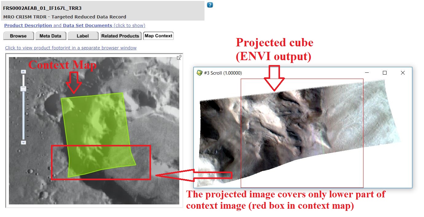
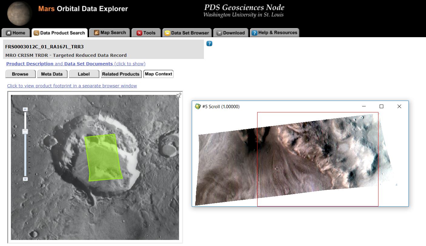
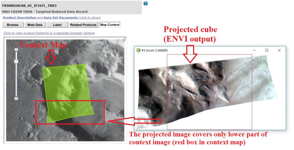
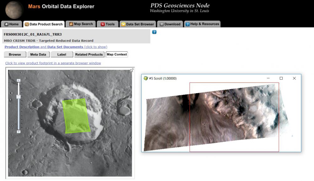
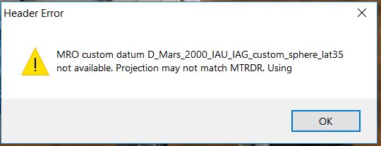
Dear all, I have been trying to use CRISM TRDR (trr3) image of ''FRS0002AEAB_01_IF167L_TRR3'' and ''FRS0003012C_01_IF167L_TRR3'' using CAT in ENVI. However, after standard corrections (ATP), I tried to project the image cube using ''Project Single Cube Data'' option. I got a projected image of bad shape which does NOT match with map context image and kml shape (attached the screenshots). I guess only a part of the image was projected. Also, CAT showed a message after performing the processes (attached also). Can anyone please let me know how can I fix the problem? Thank you, Emran
-
Hello, I notice that when I use the CAT 7.2.1 - Map Utilities - Project Single Cube Data tool, I obtain a different result than when I use the Build GLT tool in ENVI, with: X Geometry band = Band 5 of the associated DDR Y Geometry band = Band 4 of the associated DDR according to the instructions here on slide 23. http://crism.jhuapl.edu/data/CRISM_workshop_2009/docs/agenda/CRISM_Workshop_090322_Nili_Fossae_Walkthrough_FPS.pdf Looking at the IDL projection_event.pro, I see that the lat and lon keywords are defined as follows: ; Pull some planes from the geofile lat = envi_get_data(fid=geofid,dims=dims,pos=3) lon = envi_get_data(fid=geofid,dims=dims,pos=4) Should this be bands 4 and 5 (as in the walkthrough slides) rather than 3 and 4? The filename I am using is: /home/Raw/frt00003e12_07_if166l_trr3_CAT_corr_SUM_classified_noProj.img I know in find_geofile.pro that an automatic search is done for the ddr associated with the default trr3 name, but I'm not sure if it would find the ddr associated with mine as the filename has been altered from the standard CAT convention. Essentially I am wondering which projection method is more correct. Regards, Elyse