Search the Community
Showing results for tags 'nac_cdr'.
Found 2 results
-
Hello all, I am working with LROC NAC EDR/CDR images and processing them using GDAL (not ISIS). I use LROC QuickMap only as a visual reference to verify the orientation of the images; I understand that the NAC is a pushbroom (line-scan) camera and that the EDR/CDR products are stored in camera space, while QuickMap uses SPICE kernels to generate map-projected images. I observed that some NAC images require only a horizontal flip, while others require a 180° rotation. I would like to understand what determines the correct orientation.More interestingly, I found that even images acquired during the same descending pass (same flight direction) can have different orientations. My questions are: 1.Which metadata or parameters(ie. Orbit number, North Azimuth, season) determine whether a raw NAC image requires a horizontal flip, vertical flip, or 180° rotation? 2.Can this be determined directly from the PDS label/metadata of NAC product without using ISIS? 3.Is there a recommended GDAL-based workflow to automatically orient raw NAC images correctly? Any guidance would be greatly appreciated. Thank you.
-
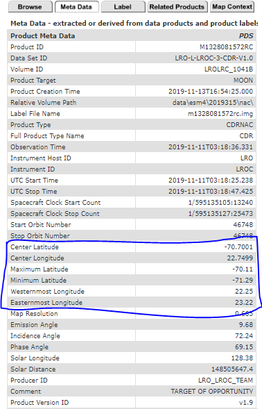
Hello all, I have downloaded the following LROC NAC CDR files from the Lunar Orbital Data Explorer Node https://ode.rsl.wustl.edu/moon/indexproductsearch.aspx M1328074531LC M1328074531RC M1328081572LC M1328081572RC M1328088614LC M1328088614RC I need to know the latitude and longitude coordinates corresponding to each of the 52224*5000 pixels. The meta data section corresponding to the results on the above link only lists the center and extreme latitude/longitude coordinates. Kindly let me know how to proceed forward. Thanks Ayushman