Hello My name is Vidyesh Sathe, I am actually working on my Dissertation in Planetary Geology, I am pretty new to Crism Data Set and Analysis of Crism Data. I am using Data set which is frt0001176e_07_if164ds_trr3.img and frt0001176e_07_if164l_trr3.img, i am using both VNIR And IR data. sir I followed the process given in CRISM Demonstration: Data Access, Processing, and Analysis - 3rd Planetary Data Workshop 2012,
After pre-processing given in presentation, I wanted to Combine both VNIR and IR data. so i followed standard Envi process which is,
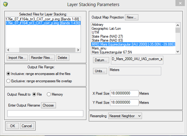
Envi-Basic Tool-Layer stacking
I imported both map-projected images of VNIR(S) and IR(L).
But as the result the image was completely Black but the information was present(Spectra information from 0.5-3.9)
I will be really grateful if you can explain to me what i am doing wrong, and what should I do to correctly project the image.
Thank You.


")
.thumb.png.33b8f16d9db3d6a53d910500f2f02e46.png)
.png.2b590320d4e91bec8444dcfaa80b7b0d.png)